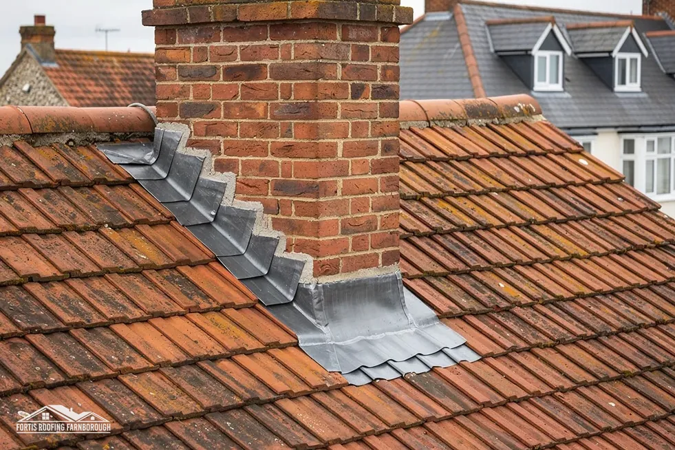
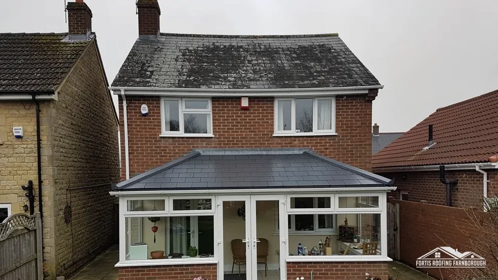
A High Street before 1914
The council's appraisal says most buildings on the High Street date from before 1914.
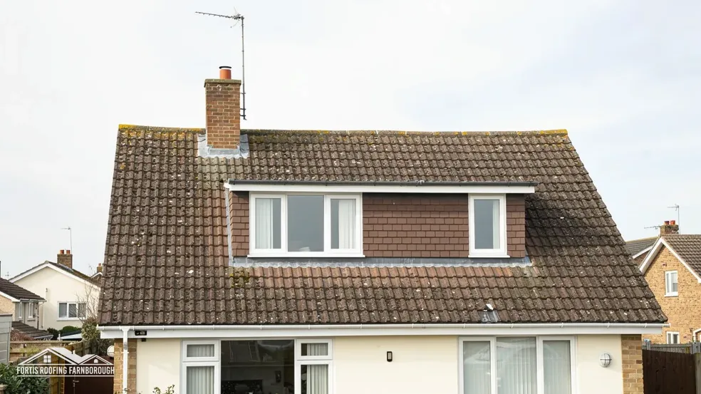
Roofs by the toll bridge at the foot of the Chilterns
Whitchurch-on-Thames lies at the bottom of the Thames valley, opposite Pangbourne, with the land rising sharply behind it. Our survey looks at every slope in turn.
The council's appraisal says most buildings on the High Street date from before 1914.
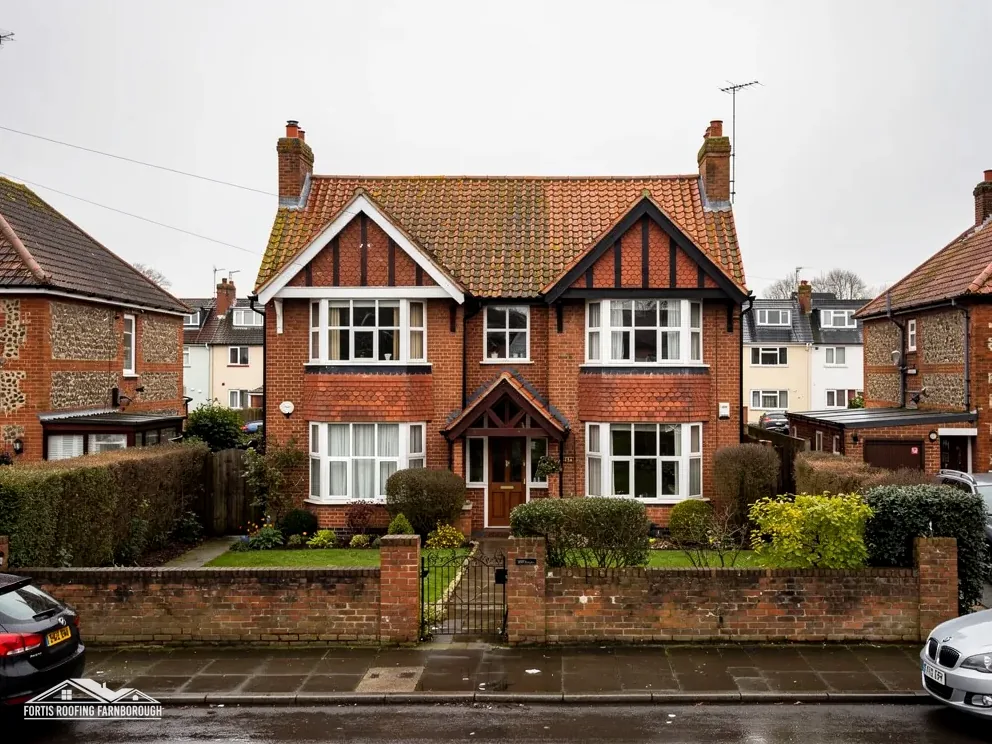
Most building along Eastfield Lane and Hardwick Road dates from the mid to late 20th century.

The village road, probably Roman in origin, once crossed the Thames by a ford near the present toll bridge.
Map of Whitchurch-on-Thames with Pangbourne, Purley on Thames, Woodcote, Tilehurst marked around it.
Map data © OpenStreetMap contributors. Loads only when you ask for it.
The village lies at the bottom of the Thames valley opposite Pangbourne, at about 40 to 50 metres, with Farnborough 29.1 road miles away, south-east of it.
About 29.1 road miles north-west of Farnborough · South Oxfordshire District Council and Oxfordshire County Council.
Whitchurch, ridges and verges
Why ridge, hip and verge tiles are no longer left to mortar by itself, what the appraisal says of Whitchurch's materials and streets, and how two conservation areas and a Grade II* church shape a repair.

| No. | Chapter | The figure it turns on |
|---|---|---|
| 01 | Ridges, hips and verges: mortar or dry-fix | BS 8612 tests dry-fix systems |
| 02 | Red brick, flint, tile and slate by the river | Most High Street buildings pre-1914 |
| 03 | Two conservation areas, a church and the Chilterns edge | 75 per cent in the Chilterns |
Chapter 01 of 03
Fixing ridge, hip and verge tiles, in what Marley and BSI publish
Three parts of a pitched roof meet the weather head on: the ridge along the top, the hips running down its corners, and the verge, which is the roof's edge at a gable end. Each is covered by special tiles, and each used to be bedded in mortar. That has changed, and it is the first job we do on a Whitchurch roof whose pointing has cracked.
The 2014 revision of BS 5534, Marley explains, treats a mortar bed as unreliable on its own for holding ridge and hip tiles. BS 8612 is the test standard for dry-fix systems at ridge, hip and verge, which hold the tiles with clips, screws or straps and use mortar, if at all, only as a finish. Both standards are current. Mortar itself is not banned. It is just not trusted alone.
Marley also says installing to BS 5534 is not required by law. That is worth knowing, because a roofer who tells you it is a legal duty is overstating the case. The fair position is that BS 5534 is the recognised code of practice, that following it is sensible, and that a ridge fixed to it is held mechanically, not by mortar alone.
If a ridge or hip is loose, the survey records how it is fixed, photographs the cracks and says whether the tiles can be refixed. Where they are sound we usually re-lay them with dry-fix fittings. At a verge we look at the tiles, the undercloak beneath, which is the strip that supports the edge tiles, and whatever holds the last tile down. You get the findings with photographs before a price is written.
South Oxfordshire District Council plans for Whitchurch-on-Thames, and your building control body is whichever takes the application. A ridge refixing normally needs neither, since it falls far below the Planning Portal's limits.
Ridge and hip repairs are usually done from a roof ladder or a low scaffold, and the hips are dealt with in one visit so that no part of the roof is left open at dusk. Where a scaffold is needed on a pavement, the highway authority's licence under section 169 of the Highways Act 1980 applies, and the scaffolding firm and we settle the layout beforehand.
Chapter 02 of 03
| Where | What the appraisal records |
|---|---|
| High Street | Most buildings date from before 1914 |
| Eastfield Lane and Hardwick Road | Most building is of the mid to late 20th century |
| Building materials | Red brick with flint, timber framing and render |
| Roof coverings listed | Plain clay tiles and Welsh slate |
| The village road | Probably Roman; crossed the Thames by a ford near the toll bridge |
South Oxfordshire's conservation area appraisal for Whitchurch-on-Thames is a useful document, and we read it before surveying. It says most buildings on the High Street date from before 1914, while most building along Eastfield Lane and Hardwick Road dates from the mid to late 20th century. The village road, probably Roman in origin, once crossed the Thames by a ford near the present toll bridge.
The appraisal's list of building materials is red brick with flint, timber framing and render, with plain clay tiles and Welsh slate on the roofs. Red brick is the commonest walling, and flint appears on boundary walls. That is a description of the village, and it gives us the range of coverings we may meet and have to match. It cannot name what any single house carries, which is why every slope is photographed and recorded.
Two periods of building call for two kinds of attention. A High Street building from before 1914 may have a roof well over a century old, with a covering renewed once or more, and its flashings and valleys may be original. A house in Eastfield Lane from the 1960s or 1970s has a younger roof, but one that is now fifty years old and approaching the time when repairs become frequent.
The village sits low, at about 40 to 50 metres, with land rising sharply to the Chilterns plateau to the north. The 2021 Census counted 841 usual residents in the parish. For a roofer the point is access: the appraisal notes that the High Street's gradient becomes notably sharper towards its northern end, and we plan deliveries and scaffold accordingly.
Where your roof joins a neighbour's, the junction is recorded by camera from our own side. We describe it to you, and the talk with next door stays yours.
Parish and listings
Brick and flint walls carry a roof differently from a timber frame. A recorded history of repairs also helps when the house is sold. Brick is stiff and flint walls are thick, so movement is small, but chimney stacks on gables can lean where the footings have settled. We check stacks for lean as part of every survey and photograph any we find, so that a rebuild is planned before the next gale and not after it.
Chapter 03 of 03
Whitchurch's designations and listings, in four counts
The national dataset lists two conservation areas near Whitchurch-on-Thames, Pangbourne and Whitchurch itself. The Pangbourne area lies within about 0.75 km of the village centre, across the river. Pangbourne's boundary is held by West Berkshire Council and the Whitchurch boundary by South Oxfordshire, so the question goes to whichever council is responsible before a roof is priced, and its reply is passed to you. Our planning permission and roof work guide explains how a repair differs from an alteration here.
About 75 per cent of the 1.5 kilometre area around Whitchurch-on-Thames lies inside the Chilterns National Landscape. That is most of the area. Our planning guide covers dormers and other alterations on designated land, and South Oxfordshire's planners decide any application made on this bank of the river. Repairs in matching materials are a separate and simpler matter. The remainder lies outside, so your street decides, and the council's map shows the line.
The listing of St Mary's church, at Grade II*, is dated 9 February 1959. Worship there is Anglican, so its roof falls to the faculty system. Church Cottages, Coombeside Cottage and Duchess Close are Grade II listed, three of 24 listed buildings within 500 metres of the centre, and the council grants the listed building consent needed for work altering their character.

A dated photographic record is part of every older Whitchurch job: ridges, hips, verges, chimneys and flashings, before and after. You receive it with the written price. On pitched roofing you can read how tile roofs are mended, and slate roofing deals with the Welsh slate that the appraisal also lists.
Because the village is opposite Pangbourne, the toll bridge links the two; the appraisal dates it to 1792, with the listed structure rebuilt in 2013 to 2014, and deliveries of materials are planned around the crossing. We tell you in advance when a lorry is expected and where it will stand, and nothing is left on the road overnight.
If an extension or loft conversion is in your plans, mention it when we visit, since it changes which repairs are worth doing now. The council will ask about the roof's present form, and our notes describe it in the terms planners use, which saves redrawing later and avoids a second site visit.
A mortared verge relies on a bed of mortar to hold the last tiles at the gable, while a dry-fixed verge holds them with clips or screws, tested to BS 8612. A mortar bed by itself is no longer trusted at ridge and hip, so a loose verge is usually refixed dry. We photograph the existing fixing and explain what we would use.
The council's appraisal lists plain clay tiles and Welsh slate among the roofing materials of the village, with red brick, flint, timber framing and render for the walls. That cannot tell you what your own roof carries, so each slope is named and photographed during the survey before any advice is given.
Not for its roof, because Anglican worship continues there and the ecclesiastical exemption applies, which sends roof work through the faculty system. A listed house such as Church Cottages is different: South Oxfordshire District Council grants the listed building consent for it, a point we put to the council before pricing.
The dataset lists Pangbourne, across the river and within about 0.75 km of the centre, and the Whitchurch Conservation Area. West Berkshire Council holds the Pangbourne boundary and South Oxfordshire the Whitchurch one, and each can say whether an Article 4 direction applies. They hear about any visible change before it is priced. You hear the council's answer before the quote arrives.
Get your free roof quote
Give us your Whitchurch-on-Thames address and describe the trouble briefly, and we will arrange to visit you.
10-year workmanship guarantee, in writing.